
Southern Africa
Travel to Namibia: road trip directions and tips
Namibia rewards travellers who take their time. Distances are important, the scenery is immense and the road is fully part of the experience.
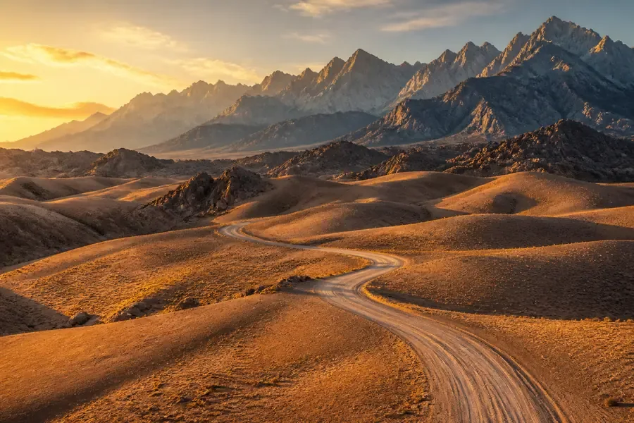
Visual illustration — scenes do not document the current conditions of the place.
Factual references
Namibia in practice
These benchmarks are used to identify the destination, read a motto and prepare contacts. They do not describe the entry conditions or the current security.
- Capital / institutional headquarters
- Windhoek
- Currency: code to be identified
- NAD · Namibia Dollar
- Telephone code
- +264
- Geographical code
- NA
The borders listed below correspond to the neighbours in the Azatour catalogue; they do not constitute an exhaustive list of all neighbouring countries.
Codes and monetary names: SIX, maintenance agency ISO 4217. Comparison of the benchmark made on October 6, 2026; the conditions of payment are verified with the provider.
Source: GeoNames, CountryInfo, import of , CC BY 4.0 license. The specific institutional seats are specified; no demographic data or exchange rates are included.
Destinations with a common land border
To consider a circuit, check separately the opening of borders, permits and transport. A common border does not guarantee an accessible crossing.
A step to understand and organize
Twiyfelfontein: observing engravings rather than adding a photo stop
Twiyfelfontein gathers rock engravings, including many animal representations. Their context helps to read the relationship between ritual practices and the lives of ancient communities.
Source of the benchmark: UNESCO World Heritage Record. UNESCO DataHub Reference . This source documents the subject; access, tickets and transport must be confirmed separately.
The decision that changes this stage
Compare a short stop with an explained route giving time to observe. Have the walk, the supervision and the conditions of the outside visit confirmed. In a road circuit, keep reading the site separate from the time it takes to reach the next night.
Three points to confirm before booking
- Proposed courses and accompanying services
- Walking and sun protection
- Road remaining after the visit
Why go?
Experiences to be missed
Use these markers to compose a program adapted to your pace. Travel times, season and accommodation location count as much as the number of places visited.
The Namib Desert
The dunes and landscapes of Sossusvlei require a morning start and a well-placed stage. Check the access times and conditions of the runway.
Etosha and Wildlife
Several nights increase the chance of observation and avoid travelling too fast. Always follow safety instructions and distances.
The Atlantic coast
Swakopmund and Walvis Bay offer a break between desert and ocean. The contrast with the interior of the country is one of the highlights of the trip.
Route idea
A route to be adapted, not to be followed
This frame helps to visualize the pace of the journey. Keep margin for transfers, weather and unexpected discoveries.
- Days 1–4
Windhoek and Namib Desert
Take control of the vehicle, then join the desert with a realistic step and time for the dunes.
- Days 5–9
Coast and Damaraland
Go up to the Atlantic before continuing towards the rocky landscapes, without underestimating the time of the trail.
- Days 10–14
Etosha and return
Spend several nights at the park and then plan a final stop before the international flight.
When to leave
Choose the right time
There is not a single ideal season: the best time depends on the areas visited, your activities and your tolerance to the influx or weather variations.
Dry season
Often preferred for animal observation and roads, with nights that can be cool depending on the region.
Warmer season
The heat and the possible thunderstorms require to adapt the steps and check the condition of the runways.
Year-round
The regional contrasts are marked: check the conditions in Etosha, on the coast and in the desert separately.
Before booking
Checks that avoid bad surprises
- Long distances and runways require realistic steps, water, a spare wheel and a route communicated to a third party.
- Compare the vehicle, tires, insurance, assistance and exclusions from the rental contract.
- Download offline maps: the mobile network may be absent on large portions of the journey.
- Entry formalities may evolve; check the official form before any final reservation.
The formalities and recommendations may change. Check them before departure and check local information to prepare visits.
Travel Reports — France DiplomacyFrequently Asked Questions
Namibia: Questions Before Departure · Global Voices
How many days does it take to travel to Namibia?
Two weeks allow a classic loop with several major steps. Three weeks offer a more flexible pace and reduce driving days too long.
Do you need a four-wheel-drive vehicle in Namibia?
Depends on the route, season and the tracks taken. A suitable, well-insured and well-insured vehicle is more important than a chosen category only on the price.
Can we drive at night?
It is preferable to avoid night driving because of the wildlife, visibility and isolation of some axes. Plan arrivals before dark.
How can we build a realistic itinerary?
Calculate the steps in hours, add breaks and keep several nights in major areas. A map that seems compact can hide long distances on the track.
Pursue as you please
Travel ideas around Namibia
These files compare several destinations according to the type of stay. They help to put this guide back in a wider choice.